Infrastructure Sustainability Intelligence Tool
Directing Capital Towards SDG-aligned Infrastructure
There is a critical need to build resilient and sustainable infrastructure and meet the Sustainable Development Goals (SDG). Unfortunately, investors often find it difficult and time-consuming to identify and invest in SDG-aligned infrastructure projects. The Infrastructure Sustainability Intelligence Tool (ISIT) helps investors to efficiently access high-quality projects, reducing global risks and capturing sustainable returns.
The prototype will undergo further refinement and its geographical scope expanded into new regions. A future iteration of ISIT will be integrated into a digital platform dedicated to project developers and investors focused on future proof infrastructure.
What Can ISIT Do for You?
ISIT can be used to quickly identify signals of sustainability and resilience in infrastructure for a large number of projects.
- For investors, ISIT supports identification of infrastructure projects potentially suitable for investment, whilst minimizing key risks such as the impact of climate change on the project, or the project’s impact on the climate and ecosystems.
- For project developers, ISIT improves visibility of good quality projects to potential investors, incentivizing developers to improve the sustainability and resilience of their projects.
- For civil society and public sector actors, it highlights the impacts of planned infrastructure projects on people and planet.
Assessment Methodology
Information on infrastructure projects is sourced using data scraping from a public database and processed using machine learning, following the steps below:
- Project-related documents, such as Environmental Impact Assessments, are sourced online and downloaded.
- The disclosed project location is pinpointed on a map.
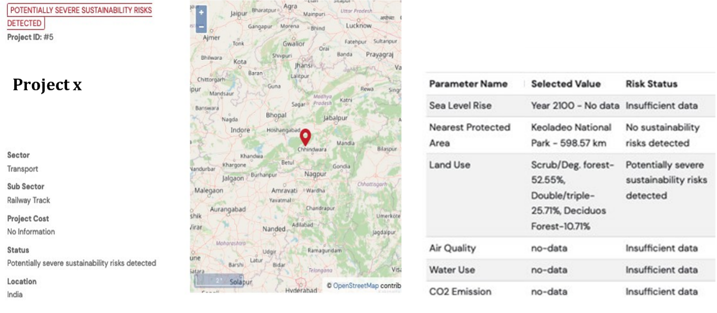
- Natural Language Processing searches for previously defined parameters in the downloaded documents. In the prototype version, there are 3 parameters: CO2 Emissions, Water Use, and Air Quality.
- A geospatial analysis allows to identify sustainability risks linked to three other parameters: Nearest Protected Area, Sea Level Rise, and Land Use.
- Based on a multi-criteria decision analysis, the project is then given a flag: insufficient data, no sustainability risks detected, moderate sustainability risks detected, or potentially severe sustainability risks detected.
Sample Results Page

